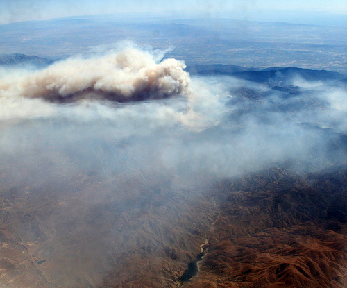
Above is a picture of the Station Fire, taken from the plane I was riding from Santa Barbara to Denver on Monday afternoon. I believe the water body at the bottom is the San Gabriel Reservoir. It lies in the midst of the San Gabriel Mountains, most of which are in the Angeles National Forest, much of which got burned up in the last two weeks.
I didn’t see this scene myself, since I was seated on the left side of the plane, with a view of the Mojave desert. But I knew the fire was there, below the right side of the plane, which had a perfect view of the burn area. So I handed my camera over to people sitting on the right side, and they made the shots.
The fire has been burning itself out in the back country, which it was doing on Monday when that shot was taken. Current stats: 160,357 acres, 71% contained, 3,647 personnel, containment expected on Tuesday September 15th, 2009, at approximately 6:00 PM. (Yes, they’re that precise.)
Leave a Reply