Desert warfare training in live ghost towns, seen from the sky

I’ve been fascinated for years by what comes and goes at the Fort Irwin National Training Center

fortirwin

—in the Mojave Desert, amidst the dark and colorful Calico Mountains of California, situated in the forbidding nowhere that stretches between Barstow and Death Valley.

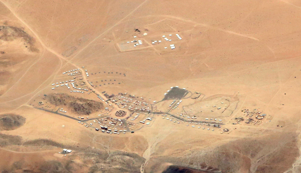
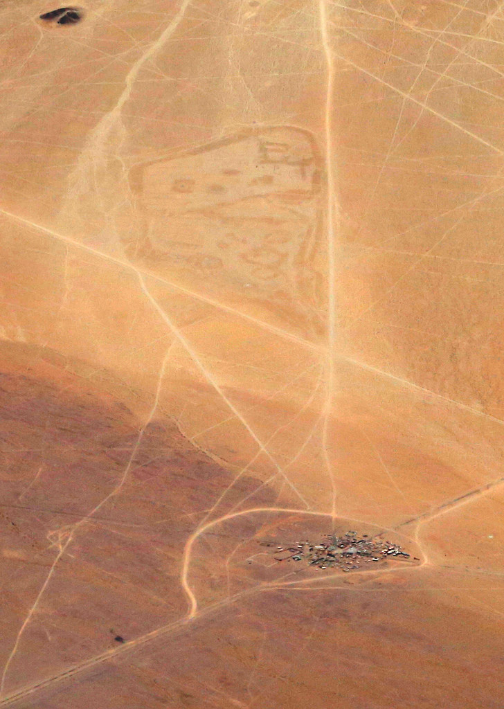
Here and there, amidst the webwork of trails in the dirt left by tanks, jeeps and other combat vehicles, fake towns and other structures go up and come down. So, for example, here is Etrebat Shar, a fake town in an “artificial Afghanistan” that I shot earlier this month, on June 2:

etrebat-shar1

And here is a broader view across the desert valley east of Fort Irwin itself:

etrebat-shar2

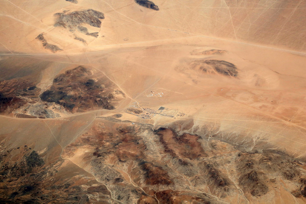
Look to the right of the “town.” See that area where it looks like something got erased? Well, it did. I took the two shots above earlier this month, on June 2. Here’s a shot of the same scene on June 25, 2013:

etrebat-shar3

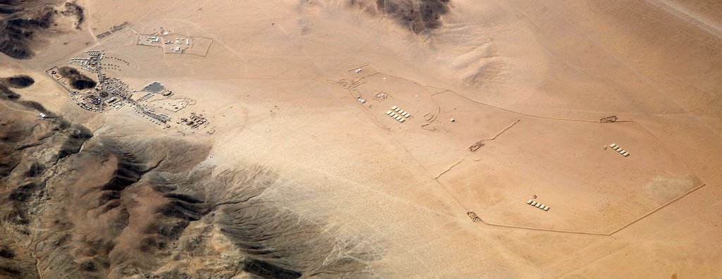
Not only is the “town” a bit bigger, but there’s this whole other collection of walls and buildings, covering a far larger area, to the right, or east.

I also see in this shot that it was gone on December 8, 2014.

Now I’m fascinated by this town and the erased something-or-other nearby, which I also shot on June 2:

othertown

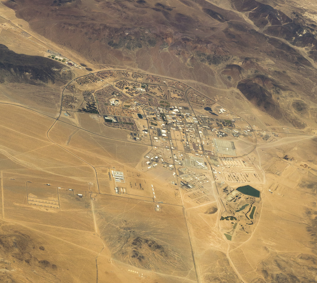
It appears to be “Medina Wasl,” which Wikipedia says is one of twelve towns built for desert warfare training:

One of the features of the base is the presence of 12 mock “villages” which are used to train troops in Military Operations in Urban Terrain (MOUT) prior to their deployment. The villages mimic real villages and have variety of buildings such as religious sites, hotels, traffic circles, etc. filled with foreign language speaking actors portraying government officials, local police, local military, villagers, street vendors, and insurgents. The largest two are known as Razish and Ujen, the closest located about 30 minutes from the main part of the post. Most of the buildings are created using intermodal containers, stacked to create larger structures, the largest village consists of 585 buildings that can engage an entire brigade combat team into a fight.

Now I’m slowly going through my other shots over the years to see if I can find Razish and Ujen… if they haven’t been erased.

It would be cool to hear from military folk familiar with Fort Irwin, or veterans who have worked or fought mock battles in those towns.


4 responses to “Desert warfare training in live ghost towns, seen from the sky”

  1. I was never stationed at Ft. Irwin but I did do a month-long rotation there in 2013, along with stints in Iraq and Afghanistan beforehand.

    When brigade-size units rotate in, the National Training Center (NTC) will deliver a training scenario in line with that unit’s outlined mission and training objectives. Due to this, the names of towns may vary from month to month.

    It might or might not be obvious that there’s a political element to the design of military training sites. 10 years ago, US military leadership put a big emphasis on counterinsurgency warfare. In that environment, I could see justifying the construction and maintenance of a mock town large enough for a BCT to train in. At the time, we were sending multiple brigades even to Baghdad alone, and they were all going door-to-door clearing houses.

    In 2016, not only do these sites cost scarce resources to maintain, but defense policymakers and military leaders might also see their continued presence as a distraction from other capabilities they’d prefer to emphasize instead. My rotation 3 years ago focused on a hybrid threat of simultaneous conventional, insurgent, and criminal activity within the area. In this environment, it’s also important to anticipate and manage flows and needs of displaced civilians. I see this model as extremely relevant for the current potential US Army mission set, without the additional money and training-time costs stemming from the monster cities you describe.

    Just one guy’s opinion; I hope it’s helpful!

  2. One other thought: the “erased something-or-other” you ask about may be the cleaned-up site of a brigade headquarters position. They’ll set up a protective berm around the perimeter using earth-moving equipment; inside that they’ll have tent cities, large command-post tents, mobile kitchens, and large motor pools with fuel storage and maintenance trailers. Everything is removed and the ground flattened back down at the end of the exercise so it’s hard to imagine what one might look like weeks or months afterwards, but I’d bet it would look a lot like that picture.

    1. Thanks, Francis. This is exactly the kind of factual response I was looking for. Very helpful.

      On the political origins of temporary towns, I suspect that NTC has left up a town or two while erasing some others, now that there is less need for urban recon and door-to-door counterinsurgency duties.

      Thanks also for alerting me on Twitter to @NTC_UPDATE. I’ll add that tag to the pix.

  3. So that’s what was going on at Nazca.

Leave a Reply

Your email address will not be published. Required fields are marked *