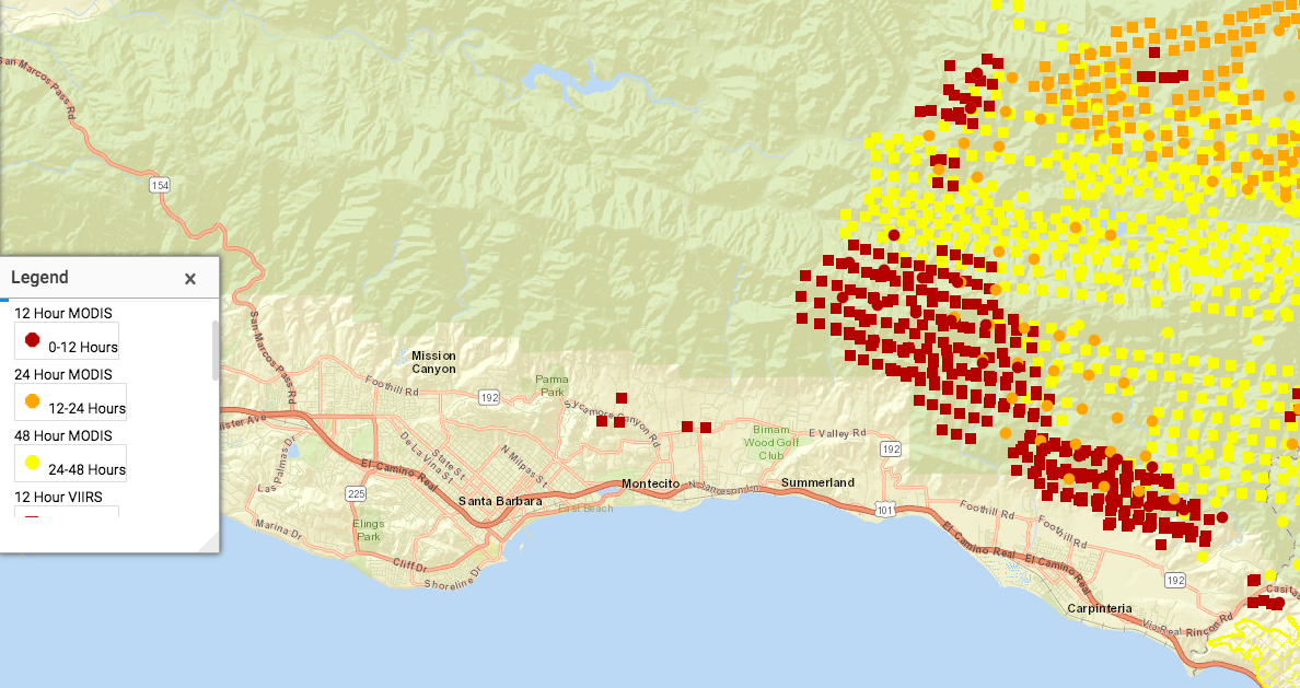
[Update: 7:22am Monday December 11] Two views of ThomasFire developments. First, MODIS fire detections, plotted on Google Earth Pro, current at 7am Pacific time:

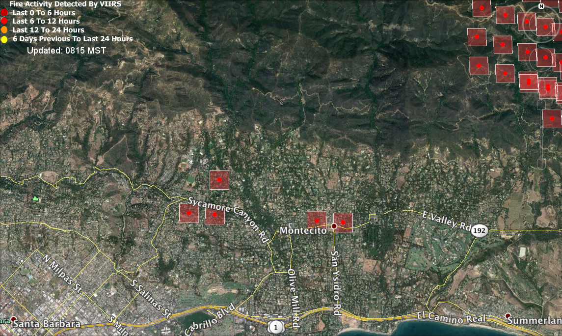
Second, a screenshot of the NCWG (National Wildfire Coordinating Group) map of the area, 7:18am Pacific time:
On the map itself, you can click on each of those squares and get more specific data. Here is the latest from VIIRS, which appears to be the source of the five hot spots in Montecito, above:
This explains now MODIS and VIIRS work together.
In listening to what local media I can (over the Net, from where I am in Los Angeles), I’ve heard nothing about the five hot spots detected in Montecito. KCLU reports that winds are slack, and smoke moving straight up, which means that firefighters may be able to restrict growth of the fire to the back country behind the spine of Santa Ynez mountains, behind Santa Barbara and Montecito.
[December 10, 3:45pm] MODIS fire data, plotted on Google Earth. The view is straight east. You can see the Thomas Fire advancing through the back country westward toward Santa Barbara, and already encroaching on Carpinteria:

Those are fire detections. Radiative power data is also at that first link.
Here is a collection of links to sources of useful information aboiut the #ThomasFire:
- National Wildfire Coordinating Group #ThomasFire active map
- Windy.com map of the area
- Live LA Times maps
- Santa Barbara County’s page on the #ThomasFire
- MODIS active fire maps page
- MODIS fire data web services
- KML files on fires
- https://maps.nwcg.gov/sa/#/%3F/34.4758/-119.5947/11
Leave a Reply