Here’s the latest satellite fire detection data, restricted to just the last twelve hours of the Thomas Fire, mapped on Google Earth Pro: That’s labeled 1830 Mountain Standard Time (MST), or 5:30pm Pacific, about half an hour ago as I write this.
And here are the evacuation areas:
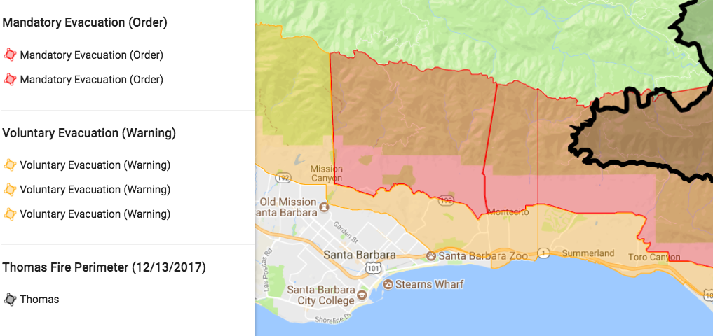
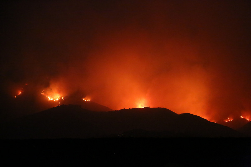
Our home is in the orange Voluntary Evacuation area. So we made a round trip from LA to prepare the house as best we could, gather some stuff and go. Here’s a photo album of the trip, and one of the last sights we saw on our way out of town:
This, I believe, was a fire break created on the up-slope side of Toro Canyon. Whether purely preventive or not, it was very impressive.
And here is a view of the whole burn area, which stretches more than forty miles from west to east (or from Montecito to Fillmore):
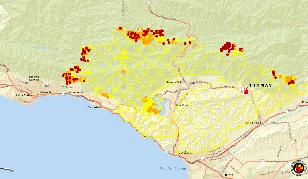
Here you can see how there is no fresh fire activity near Lake Casitas and Carpinteria, which is cool (at least relatively). You can also see how Ojai and Carpinteria were saved, how Santa Barbara is threatened, and how there are at least five separate fires around the perimeter. Three of those are in the back country, and I suspect the idea is to let those burn until they hit natural fire breaks or the wind shifts and the fires get blown back on their own burned areas and fizzle out there.
The main area of concern is at the west end of the fire, above Santa Barbara, in what they call the front country: the slope on the ocean’s side of the Santa Ynez Mountains, which run as a long and steep spine, rising close to 4000 feet high in the area we care about here. (It’s higher farther west.)
This afternoon I caught a community meeting on KEYT, Santa Barbara’s TV station, which has been very aggressive and responsible in reporting on the fire. I can’t find a recording of that meeting now on the station’s website, but I am watching the station’s live 6pm news broadcast now, devoted to a news conference at the Ventura County Fairgrounds. (Even though I’m currently at a house near Los Angeles, I can watch our TV set top box remotely through a system called Dish Anywhere. Hats off to Dish Network for providing that ability. In addition to being cool, it’s exceptionally handy for evacuated residents whose homes still have electricity and a good Internet connection. I thank Southern California Edison and Cox for those.)
On KEYT, Mark Brown of @Cal_Fire just spoke about Plans A, B and C, one or more of which will be chosen based on how the weather moves. Plan C is the scariest (and he called it that), because it involves setting fire lines close to homes, intentionally scorching several thousand acres to create an already-burned break, to stop the fire. “The vegetation will be removed before the fire has a chance to take it out, the way it wants to take it out,” he says.
Okay, that briefing just ended. I’ll leave it there.
So everybody reading this knows, we are fine, and don’t need to be at the house while this is going on. We also have great faith that 8000 fire fighting personnel and all their support systems will do the job and save our South Coast communities. What they’ve done so far has been nothing short of amazing, given the enormous geographical extent of this fire, the exceptionally rugged nature of the terrain, the record dryness of the vegetation, and other disadvantages. A huge hat tip to them.
Leave a Reply