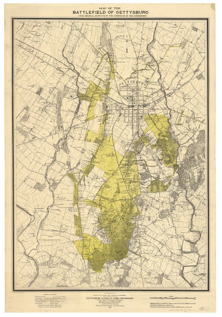
Gettysburg National Military Park 1914
Map of the battlefield of Gettysburg from original surveys by the engineers of the Commission.
Gettysburg National Military Park Commission.
1914
Commemoration of the Gettysburg battlefield began almost as soon as the battle was over, with the first land purchases for conservation made within 6 months of the July 1863 battle. The Gettysburg Battlefield Me
morial Association raised funds for more land acquisition and maintained the battlefield, until 1896 when it was transferred to the War Department.
The monuments at Gettysburg serve the dual purpose of commemorating the soldiers’ contributions to the Union cause and of documenting the course of the battle for that future. With the latter goal in mind, it was important that the monuments by located accurately, so important that at least one placement ended up being litigated in the courts. When War Department took over, some 320 monuments were included in the transfer of property. The current count stands over 1300.
This map shows the monuments and markers that were in place in 1914, along with the positions of units at various points during the battle. It also includes topography and land cover, both of which were extremely important throughout the battle. Maps like this were used for many years to study the battle and help explain why events unfolded the way they did
What you think