New Jesusita Fire Perimeter

2009_05_07_jesusita

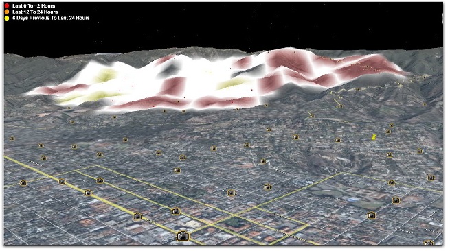
The above shows the situation, somehat. It’s a MODIS overlay on a Google Earth terrain view looking north from over downtown Santa Barbara. Go to that shot and mouse over for more.

Meanwhile, it’s clear that at least some hot spots have spread into the back country, above the city. But if those fires are still big, and the winds come strong toward town, we’ll be in very high danger.


3 responses to “New Jesusita Fire Perimeter”

  1. I wonder if you might add a timestamp to these posts? It is becoming hard to tell which is from when and how much.

  2. If it wasn’t for your blog I would have little information about this fire and the previous ones.

    Our 94 year old mom is in SB and its not very reassuring when the official web sites state to “not call 911 because the system if overloaded” and their alternative number just rings busy.

    As we learned the past few years here in San Diego, when events of these magnitude occur, you’re pretty much on your own – both assistance- and information-wise.

    Best wishes and our thoughts and prayers are with you that the winds diminish quickly.

  3. Thanks, Bill.

    Adam, thanks for the tip. This morning I decided to have one long post for today, thoughout which I’ve closed each paragraph with a time stamp. Also, if you go to the home page, the blog format will make sure the most recent stuff is on top.

Leave a Reply

Your email address will not be published. Required fields are marked *