I’ve been looking gratefully and often, over the past few years, at Louis J. Maher, Jr.’s Geology by Lightplane. The shots themselves date from 1956-1966, and he put the page up in 2001; but their subjects are the sort that don’t change much over a span of time so short as the last thirty-five years. Dr. Maher is an Emeritus Professor in the Department of Geoscience at the University of Wisconsin-Madison, and specializes in the Quarternary Period, which also happens to be the one in which we live. (More specifically, we operate in the Holocene epoch, which is the name geologists give to the last dozen millennia or so.)
Explains Dr. Maher,
I was working on a closed-circuit educational television class in geology in 1966. A problem arose while I was planning the outline of some 43 lectures. Many of the available photographs and films that I wanted to use were copyrighted. Although they could be shown free to normal classes, royalties were required once they were put on video tape. I decided to solve the problem by getting a couple of cameras and spending a month in the West filming my own material. Then a happy thought occurred to me. Why not take some of the pictures from the air? I had earned a private pilot rating in 1964 and had logged about 90 flight hours. It happened that the Geophysics Section of our Geology Department owned a Cessna 170B that had been purchased for aeromagnetic research. At the time N2398D was sitting empty at a local airport, and the University of Wisconsin agreed to absorb 100 hours of flight time for the project. Graduate student and project assistant Charles F. Mansfield indicated he was willing to come along as photographer; I could not have found a more able colleague.
I have used the color film taken during the flights of 1966 long after the black and white video tapes were discarded, and I have added to the collection over the years. While it is important to have detailed ground-based slides to illustrate geological features for introductory classes, a few shots from the air help to establish their overall relationship.
These air photos have been very useful in my teaching. I think they can be useful teaching aids for others. I have copyrighted the digital image files, but I am making 360 of them available at no cost for noncommercial educational use.
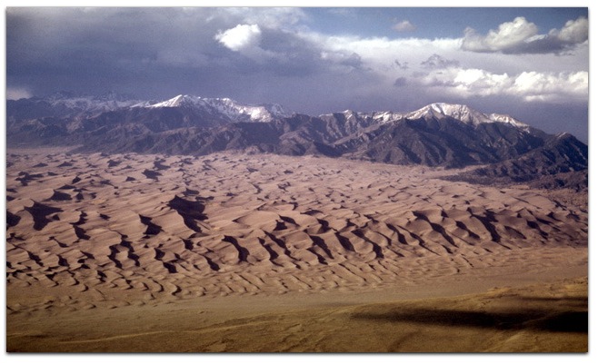
That’s also the idea behind all the photos described or tagged geology in my Flickr photo collection. Only a few of those were taken by lightplane. (Those are in this set of the San Andreas Fault, in the Carrizo Plain of California. The pilot was @DougKaye) The rest were all shot from heavyplane, at altitudes of up to forty thousand feet and more. (I think the highest was this one.) Some were shot from the ground, such as during this cross-country road trip. Here’s one sample, from a flight over Greenland:

So here’s a belated thanks to Dr. Maher for his generosity. As did he, I grant permission to anybody teaching or learning geology to use any of my shots, any way they please. All of them should be CC licensed to permit that. If you find any that aren’t, let me know and I’ll fix them.
Leave a Reply