 In Google sets out future for Maps — Lays down gauntlet to Nokia with plans for personalized, context-aware and ’emotional’ maps in future, in Rethink Wireless, Caroline Gabriel begins this way:
Google may be feeling the heat from an unlikely source, Nokia, at least in its critical Maps business. The search giant has put location awareness at the heart of its business model, but Nokia has overtaken it in several respects with its cloud-based Here offering – based on the acquisition of Navteq in 2007 – and has also licensed its mapping platform to some powerful partners such as Microsoft, Amazon and a range of car makers.
Google is promising dramatic changes to its own maps to help fend off the Nokia/Microsoft alliance and also, in the Android segment at least, the challenge from Amazon to a Google-centric experience.
As usual with stories like this, the issue is framed in terms of vendor sports: big companies doing battle over some market category. Lost, also as usual, is what the individual user, or customer, might actually want.
That’s what I’m here for.
So let me start by saying I don’t want a “Google-centric experience,” whatever that is. Nor do I want Google’s (or anybody’s) Matrix-like approach to satisfying what its robotic systems think I might need. Here’s how Caroline explains that ambition:
Bernhard Seefeld, product management director for Google Maps, told the GigaOM Roadmap conference this week that future software will “build a whole new map for every context and every person”, incorporating all kinds of information about the individual and updating this constantly. He added: “It’s a specific map nobody has seen before, and it’s just there for that moment to visualize the data.”
Pushing a major theme at Google this year, Seefeld talks about applications creating emotional connections for users – “emotional maps that reflect our real life connections and peek into the future and possibly travel there”. This will involve context-aware maps that combine location and personal data, some of that taken from other Google apps, particularly its Google Now personal digital assistant – mainly seen as a response to Apple Siri, but in fact far broader in scope, and with a powerful artificial intelligence engine.
Context-aware is fine, provided I provide the context, and the context is as simple as, for example, “I am here” and “I want to go to this other place.” I don’t want guesswork about my emotions, or anything else that isn’t on the vector of what I alone know and want. Paper maps didn’t do that, and the best electronic ones shouldn’t either — not beyond what still feels as hard and useful as paper maps always did.
See, maps are fact-based descriptions of the world. Their first and most essential context is that world, and not the person seeking facts about that world. Yes, map makers have always made speculative assumptions about what a map reader might like to know. But those assumptions have always been about populations of readers: drivers, aviators, hikers, bike riders, sailors, geologists, etc. That they don’t get personal is a feature, not a bug.
A brief story that should tell you a bit about me and maps.
In October 1987, on the way back to Palo Alto after visiting my daughter at UC-Irvine, my son and I noticed it was an unusually clear day. So we decided to drive to the top of Mt. Wilson, overlooking Los Angeles. On the way we stopped at a fast food place and ate our burgers while I studied various AAA maps of Southern California and its cities. When we arrived at the top, and stood there overlooking a vista that stretched from the San Bernardino mountains to the Channel Islands, four guys from New Jersey in plaid pants, fresh from golfing somewhere, asked me to point out landmarks below, since I already was doing that for my son. The dialog went something like this:
“Where’s the Rose Bowl?”
“Over there on the right is Verdugo Mountain. See that green stretch below? In there is the Rose Bowl.”
“Oh yeah.”
“On the other side of Verdogo is the San Fernando Valley. South of that are the Hollywood Hills.”
“Is that where the Hollywood sign is?”
“Yes, on the south side, facing Hollywood. Mulholland Drive runs down the spine of the hills on the far side of the Sepulveda Pass, where the 405 passes through. The Malibu Hills are beyond that. You can see the buildings downtown to the left of that. Long Beach and San Pedro, Los Angeles’ port cities, are to the left of the Palos Verdes peninsula, which are the hills over there. You can see Santa Catalina Island off beyond that.”
“Where was the Whittier Earthquake?”
“Over there in the Puente Hills. See that low ridge?”
“Yeah. Wow. How long have you lived here?”
“I don’t. This is only my second trip through. I live up north.”
“Where are you from?”
“New Jersey, like you.”
“How do you know so much about all this around here?”
“I study maps.”
Of which I have many, now mostly mothballed in drawers. 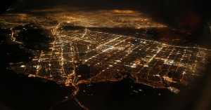 I have topo maps from the U.S. Geological Survey, sectional charts from the FAA, maps atlases from the Ordnance Survey in the U.K., and many more. When I fly in planes, I follow the scene below on my laptop using Garmin Road Trip (an app that is sorely in need of an update, btw.) That’s how I can identify, literally on the fly, what I see out the window and later detail in my aerial photo collections on Flickr.
So, having presented those credentials, I rate Google’s Maps mobile app at the top of the current list. Google’s search is great, but substitutable. So are many other fine Google services. But I have become highly dependent on Google’s Maps app because nothing else comes close for providing fully useful facts-on-the-ground. Here are a few:
- Transit options, and arrival times. Here in New York one quickly becomes dependent on them, and they are right a remarkable percentage of the time, given how uneven subway service tends to be. Hell, even in Santa Barbara, which is far from the center of the public transportation world, Google’s Maps app is able to tell me, to the minute, when the busses will arrive at a given stop. It’s freaking amazing at it.
- Route options. Even while I’m on one route, two others are still available.
- Re-routing around traffic. It doesn’t always work right, but when it does, it can be a huge time/hassle saver.
- Timeliness. It couldn’t be more now, and a living embodiment of the Live Web at work.
I also like Here, from Nokia. (As you can see from my collection of maps apps, above. Note the second dot at the bottom, indicating that there’s a second page of them.) I also have enormous respect NAVTEQ, which Nokia bought a few years back. NAVTEQ has been at the map game a lot longer than Google, and is at the heart of Here. But so far Here hasn’t been as useful to me as Google Maps. For example, if I want to get from where I am now to the meeting at NYU I’ll be going to shortly, Google Maps gives me three options with clear walking and riding directions. Here gives me one route, and I can’t figure how to get the directions for taking it. (Both are on my iPhone, btw.)
So here is a message for both of them, and for everybody else in the mapping game: Don’t subordinate pure mapping functions to a lot of “emotional” and other guesswork-based variables that advertisers want more than map readers do.
This might also help: I’m willing to pay for the maps, and services around them. Not just to avoid advertising, but to make those services accountable to me, as a customer, and not as a mere “user.”
As advertising gets more and more personal, and more creepy in the process — without any direct accountability to the persons being “delivered” a “personalized experience” — a market for paid services is bound to emerge. I’ll enjoy being in the front of it.

Leave a Reply