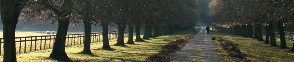
Our escape from Quito and bus trip to Banos was as exciting and as exactly choreographed as a chase scene in a blockbuster action flick, except, of course, no one was chasing us and we never broke 50 miles an hour. We arrived at the Quito bus terminal, a vast, multi leveled cement catacomb seemingly built into the side of a mountain at exactly noon. Finding the agency “Banos Express” was easy; there was a nice new bus just pulling out as we hopped aboard. We were literally still getting seated as the big Mercedes diesel left the dock and headed out of town; had we arrived 30 seconds later we would have had to wait at least an hour for the next bus. We were still in the outskirts of the urb when we witnessed our first spectacular surprise. As we were approaching the city-block sized factory of the Chaide & Chaide, Ecuador’s major mattress manufacturer, in a busy industrial district at the southern extreme of the city, someone on board yelled, “Look, flames! It’s on fire!” Luckily he was not referring to the bus, but to the mattress factory, which was indeed going up in flames. The fire was obviously out of control and recently started; while the flames shot 30 or 40 feet into the clear blue sky, workers nonchalantly strolled out of the factory, unaware of the seriousness of the situation. Cops on the corner stared in confusion, uncertain what to do. As the bus pulled slowly past the factory, just a few meters from the flames, the heat became intense. Passengers started yelling at the driver, “Hurry up!” “Keep going!” and “Don’t stop!”, obviously good advice. Not only did we hear a series of explosions as we pulled away, but we were practically the last vehicle allowed to pass the site. Out the back window of the bus we could see the cops shutting down the street hand herding rubberneckers away in anticipation of the arrival of the firemen. We read in the paper the next day that although, thankfully, no one was killed, the entire district was shut down for several hours while they brought the blaze under control. Again, had we arrived 30 seconds later we would have been trapped for at least a couple of hours. The bus was full, the surrounding countryside visible above the city skyline was a bounty of beauty, there was construction going on all around the edges of the city. We could hear a caconaphy of fire and police sirens as we pulled away. Fifteen minutes into the trip, the buildings started thinning out and the green hills, shrouded in wispy clouds, became more visible. The cobalt blue sky was festooned with fluffy cumulous clouds, cartoon shapes and gigantic cloud liners riding the ridge the road followed. Behind us an ugly black smudge of smoke marked the mattress factory fire. The rolling hills along our route are divided; farms below and forests higher up. Although the road is decent, the shocks on the bus are not, and it is hard to write on the bouncing bus, just as it is hard to read some of our notes now, the following day, as we transcribe them. The farming areas outside of town are a patchwork quilt in shades of green as the twisty road descends into a valley. Alongside the route we can see roadside produce stands, mountains of bananas, corn and many cows in the fields. The land in this section, close to the city, is divided into ranches and villas, obviously owned by rich farmers and merchants. Painted white wooden fences and cruder strands of barbed wire separate pastures and planted fields, little knots of habitation along the roadside, houses of brown brick and cement or cinder block (known here as hormigon), painted in the Ecuadorian style only on the side facing the highway, left raw and unfinished to American eyes on the other three. The produce being sold and transported changes from district to district. Here it is watermelon and long plastic bags of Andean limes. The predominant trees are scratchy pines on the right, tall eucalyptus on the left. The larger ranches and fincas are gone, now, away from the rich suburbs, we see stores and modest homes with corrugated iron roofs, businesses selling farm equipment, plows, tractors and backhoes. 15 miles out of Quito and still a thin column of black smoke can be seen behind us. For moments the bouncing of the bus makes it impossible to write. We close our eyes to the afterimage of sun streaking through rain clouds on the higher hills to the left and listen to the weird Andean pop music the driver has on the bus radio, like a lite romantic cross between salsa and rumba. 30 minutes out, the rain hits the road, briefly, without obscuring the sun – sun showers as we cross the dividing line between Pichincha province and Cotopaxi. The fields here are speckled with little yellow wildflowers, making them look like an impressionist painting in the pointilism technique, Monet maybe. As we approach the city of Latacunga we pass a flatbed truck staining under the weight of two army tanks under blue tarps, their cannon sticking out at each other and crossing over the middle of the flat bed. Norma Yvonne, who is a bit high-strung at the best of times and has a low fear threshold, keeps time to the music by tapping my hand, and clutches my arm and squeezes every time the bus breaks hard or tries a passing maneuver on a curve. We are now on the wide valley floor, flat grassy fields on both sides. We pass an Ecuadorian Special Forces military camp, which explains the tanks. Over the entrance is a sign – “Avenue of the Immortals”. Men in uniforms are coming and going in jeeps and on foot. We enter Latacunga, a typical Andean market city, produce markets and stores for farming supplies, modest houses and schools, soccer fields, pharmacies and stores selling electrical appliances, mechanic’s garages and building supplies. Out of the city now and into a zone of dairy farms and roadside stands selling homemade cheese. Norma is singing along to the radio – she knows all of the words to all of the songs popular before we stole her heart and Shanghaied her to the States 10 years ago. We pass a sign reading “Entering Salcedo – 2,876 meters above sea level” a district famous for its flowers, honey and ice cream. Ice cream stores on every corner, sometimes five or six in a block. Since we are on the Panamerican Highway, the main North-South highway down the spine of the Andes, a route known in this area as the “Corridor of Volcanoes”, there is really no undeveloped land alongside the road. The route is lined with homes, businesses and access roads leading to higher, smaller towns, capillaries of capitalism. Now we are entering Ambato, one of the larger cities of the highlands and only 45 minutes from Banos. This is a real city, with large lots dedicated to the sale of cars and heavy farm machinery, a university, airport and major league soccer team. When the bus stops to let off passengers near the train station a flaming gay guy sitting on the top of a cement bench, seeing our camera, shouts “Take my picture! Take my picture NUDE!” Norma thinks he wants to grab the camera and tells us to close the window. We don’t, but keep the camera clutched below window level. The road winds up, out of town, 45 minutes now to Banos. Passing grain elevators and a cement factory, a huge San Pedro plant with a hundred arms and certainly containing enough mescaline to float a thousand-man rave. On the outskirts a tourist zone featuring pizzerias, handicraft stores, hippie-influenced cafes. For one brief instant we pass a loud radio tuned to the same station as the bus radio and experience a sort of surreal stereo, right ear out the window, left ear aboard the bus. Quickly we fly through a town consisting almost entirely of two lines of stores on either side of the road selling locally produced denim products, jeans of all sorts and labels, including Levi’s and designer tags (fakes of course), skirts, jackets, purses and shoes, popular with smart shoppers both national and foreign. During this last stretch, the smaller highway between Ambato and Banos, we finally leave the incessant commerce behind, and pass through true countryside. The road winds and twists downward through the hills, plunging through a sea of green, steep rocky facades and terraced farmer’s fields, occasional signed businesses like “Luna Bonsai”, a Japanese botanical garden. The road keeps dropping, as Banos lies at a comfortable 1,900 meters above sea level, halfway down the far side of the Andes towards the hot, humid treasure house of the Amazon basin, less than an hour from the true jungle. At the entrance to Banos capitalism reappears in the form of billboards advertising hotels, restaurants, vacation complexes, banks. We have arrived, after an overlong absence of 3 years, at one of our favorite places on the face of the planet – A Little Piece of Heaven on Earth – the city of Banos, Ecuador. |
-
Archives
- September 2020
- August 2013
- February 2012
- January 2012
- September 2011
- August 2011
- February 2011
- January 2011
- September 2010
- August 2010
- June 2010
- May 2010
- April 2010
- June 2009
- April 2009
- March 2009
- December 2008
- September 2008
- August 2008
- July 2008
- June 2008
- May 2008
- April 2008
- March 2008
- February 2008
- January 2008
- December 2007
- November 2007
- October 2007
- September 2007
- August 2007
- July 2007
- June 2007
- May 2007
- April 2007
- March 2007
- February 2007
- January 2007
- December 2006
- November 2006
- October 2006
- September 2006
- August 2006
- July 2006
- June 2006
- May 2006
- April 2006
- March 2006
- February 2006
- January 2006
- December 2005
- November 2005
- October 2005
- September 2005
- August 2005
- July 2005
- June 2005
- May 2005
- April 2005
- March 2005
- February 2005
- January 2005
- December 2004
- November 2004
- October 2004
- September 2004
- August 2004
- July 2004
- June 2004
- May 2004
- April 2004
- March 2004
- February 2004
- January 2004
- December 2003
- November 2003
- October 2003
- September 2003
- August 2003
- July 2003
- June 2003
- December 1969
-
Meta
Michael, we are really surprised to read about our company in your article. We found your story kind of funny, but at the time of the fire, we were really worried. I work at Chaide y Chaide, the mattress factory that went up in flames, which is a family owned business. Fortunately, everything is back to normal now, we’ve decided to move to a new plant which is under construction, and will be ready around May this year. If you ever come back to Ecuador and decide to travel to Banos again, feel free to drop by our new plant which is further south of the city, also on the way to Banos.
I have a niece wo would like to study in Harvard, do you work at the university?
Tarps are measured not only by length and width, but also by the weight of the fabric that is found in each square yard and the thickness of the material.